The Glenbuchat Image Library
No: 2320 Contributor: No Contributor Year: 1861
21 Glenbucket Estate Preparatory Map 1861


Estate Preparation Map 1861
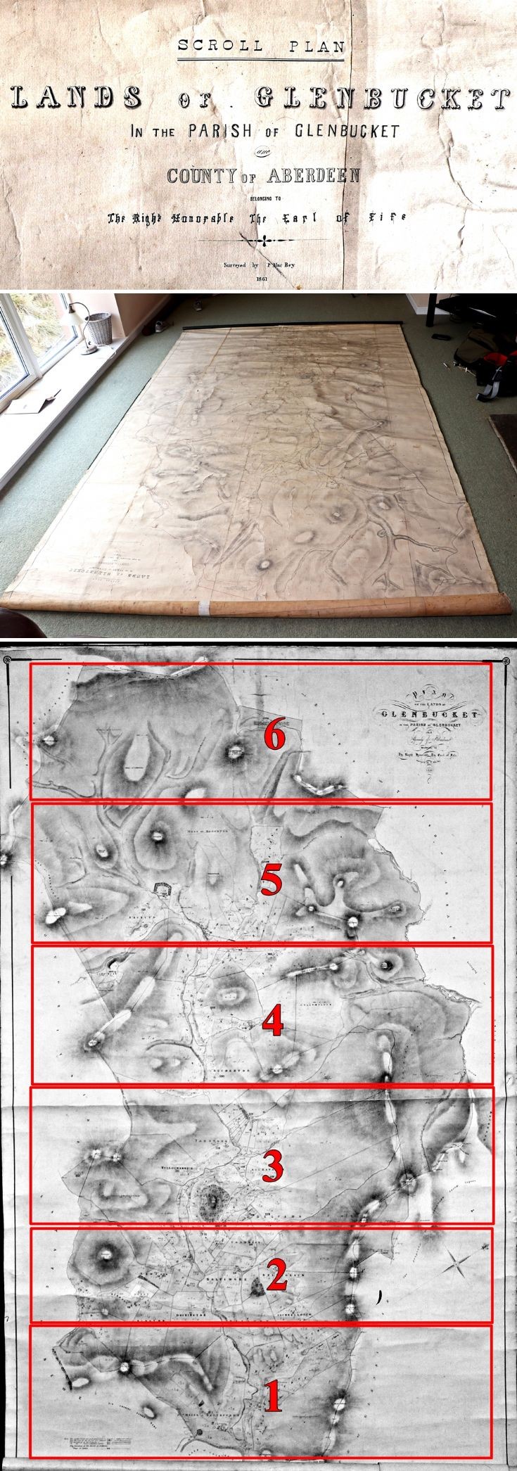
In 2019, in the attic of a cottage in Glenbuchat, there was found a large rolled up map. It is a map of the Glenbuchat estate which was produced in 1861 by Mr P McBey. It is assumed that this was the preparation map, produced before the final map of 1864 which is shown in the previous pages.
Click for the Estate map of 1864
The map is mainly un coloured and has written in details of all the names of the tenants of the various properties and there are also some general remarks.
The pictures above show;
1. Map Title 1861
2. The original map laid out
3. The divisions in the map to orientate the smaller sections
The may was photographed in daylight on the floor and it is difficult to stich the separate photos into composite sections. Each section photo is marked Left, Middle or Right to help you orientate them.
Smaller pictures highlight certain houses and groups of houses in the glen.
Click below for the appropriate photos:
Section 1
Section 2
Section 3
Section 4
Section 5
Section 6
Badenyon and Ballochduie
Balnacraig
Baltimore and Belnaglack
Belnaboth
Belnacraig
Church and Kirkton
Corrymore Quarry
Easterbucket
Lodge and Backies
Netherton and Crofts
Peatfold
Ryntaing
School Croft
Sunnybrae
Tuollocharrich and Tarantoul
Upperton
Upperton Crofters
Glenbucket Castle
 View Large Version
Picture added on 14 February 2021 at 15:10
25 Ken Cruickshank Collection Album 5


